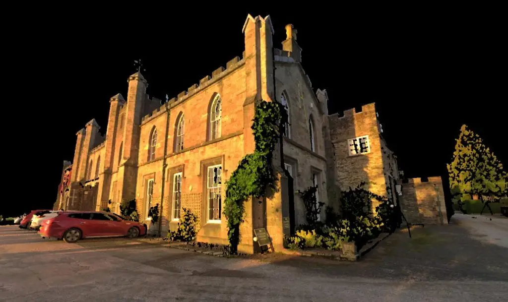
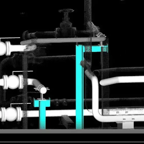
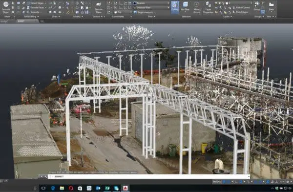
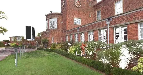
High-density 3D laser scanning delivered as a point cloud, providing a detailed visual record of the existing environment without the need for immediate drawings or additional modelling.
The first and primary output from a 3D laser survey
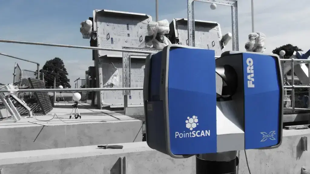
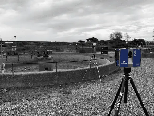
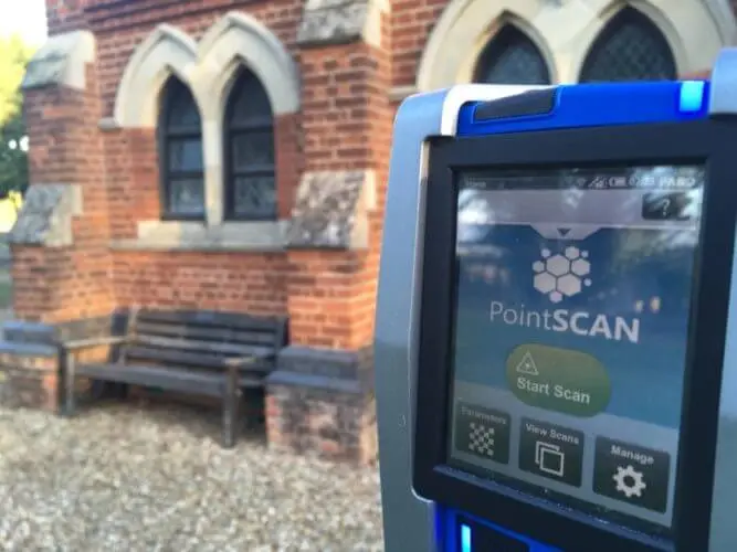
A point cloud survey involves capturing millions of precise measurement points using a terrestrial 3D laser scanner. Each point records its position in three-dimensional space, creating an accurate digital representation of the existing environment at the time of survey.
The point cloud is the first and primary output from a 3D laser survey. In a point cloud survey, this dataset is issued as the final deliverable, rather than being immediately converted into 2D drawings or 3D models. The survey is therefore specified to produce a high-density, visually detailed point cloud that can be viewed, measured and interrogated directly.
This approach is particularly effective where a reliable digital record is required for coordination, verification or future design work. The point cloud can be shared across project teams and retained as a source of truth, allowing further drawings or models to be developed later if and when they are needed.
Where further documentation is required, the point cloud remains a trusted source of information that can be returned to again and again at any stage of the project.
High-Density Point Cloud Surveys for Confident Decision-Making
Point cloud density plays a critical role when survey data is intended to be used directly. In a point cloud survey, the dataset itself is the primary output, so clarity, visual detail and usability are essential.
Higher-density point clouds provide clearer definition of surfaces, edges and interfaces, making it easier to understand existing conditions, assess spatial relationships and work confidently within the data without relying on simplified drawings or models.
Because density is defined at the point of capture and cannot be meaningfully increased later, specifying the survey correctly from the outset ensures the resulting point cloud remains a reliable digital record throughout the project lifecycle.
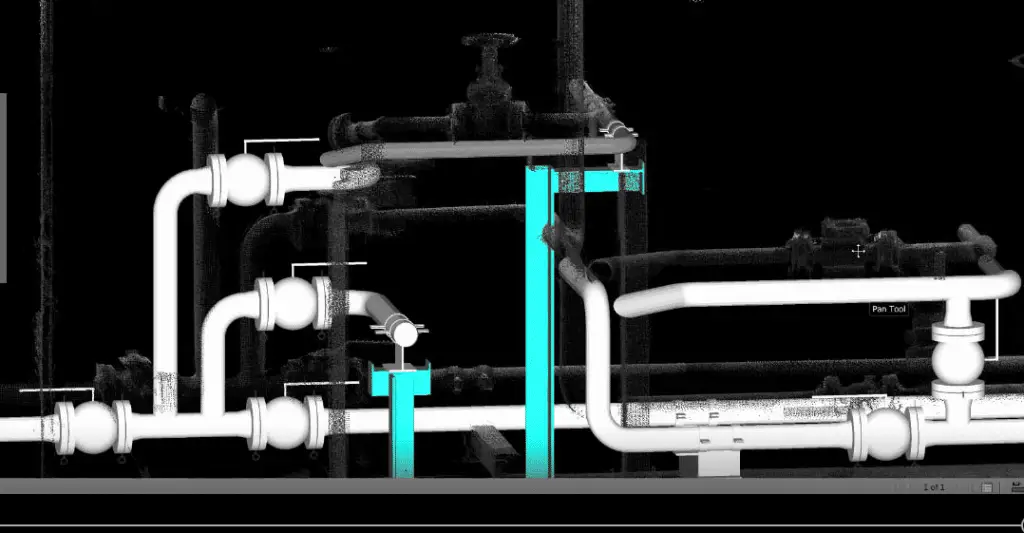
Point cloud surveys allow proposed 3D CAD or BIM models to be imported directly into the surveyed environment. By positioning design data within the point cloud, teams can assess how proposed works relate to existing site conditions with clarity and confidence.
Typical applications include:
Site recognition and orientation Understand how proposed structures, plant or infrastructure sit within the existing environment.
Clash detection and clearance checks Identify conflicts with existing assets, structures or constraints before work begins on site.
Verification of spatial assumptions Confirm levels, alignments and available space against real-world conditions rather than assumptions.
Design coordination and review Review proposed designs in context with engineers, contractors and stakeholders using a shared reference.
Construction planning and sequencing Support method statements, access planning and installation strategy using accurate survey data.
environment. These allow users to navigate the site virtually, providing an intuitive way to understand spatial relationships, constraints and context without being physically present.
Flythroughs are generated directly from the point cloud data, meaning they represent the site exactly as surveyed, rather than a simplified or interpreted model.
How flythroughs are typically used:
Design review and coordination Walk through complex environments to review proposals in context and discuss interfaces clearly.
Stakeholder communication Present existing conditions to clients, planners or non-technical stakeholders in an accessible format.
Access and safety planning Review confined or hard-to-access areas virtually to support method statements and risk assessments.
Project briefings and presentations Use visual walkthroughs to explain site conditions, constraints and opportunities quickly and clearly.
Remote collaboration Allow distributed teams to review the same dataset without the need for site visits.
Flythroughs provide a clear visual understanding of the site, helping teams make informed decisions earlier and reducing the need for repeated site visits.
Reducing Survey and Modelling Costs with Point Cloud Data
Using point cloud surveys strategically can help reduce overall project costs by avoiding unnecessary modelling, rework and repeated site visits. By capturing a high-density point cloud as the first output, project teams gain flexibility in how and when further deliverables are developed.
Cost efficiencies can be achieved by:
Using the point cloud directly Many coordination, verification and planning tasks can be completed without immediate 2D drawings or 3D models.
Avoiding over-specification Specifying only the level of detail required for the project helps control both survey and modelling costs.
Scanning once, using the data multiple times A well-specified point cloud can support future design stages, variations and asset records without re-surveying.
Reducing site visits Teams can interrogate the site virtually, saving time and minimising disruption.
Phasing deliverables Drawings or models can be developed later, only if and when they are required.
Receive a fast, accurate quotation for your next project — whether it’s industrial, commercial or residential. Provide a few project details below and one of our survey engineers will prepare a tailored proposal, including scope, deliverables and timescales
Alternatively give us a call on 01767 661400 and a member of our team will be happy to discus you project requirements
3D LASER SCANNING
MEASURED BUILDING SURVEYS
3D MODELLING
TOPOGRAPHICAL SURVEYS
BIM MODELLING
TOPOGRAPHICAL SURVEYS
VIRTUAL REALITY
2D PLANS & ELEVATIONS
Uncovering the Benefits of Point Cloud Surveys for Your Project
Point cloud surveys are continuing to drive innovation in the way in which we acquire and record measurement data from physical environments such as sites, buildings or plant facilities. With the help of 3D laser scanning, we can acquire high-definition 3D imagery which can be applied throughout your design, delivery and completion processes. At PointSCAN, we work with designers, architects, engineers, consultants and project managers throughout the UK, to create efficiencies by providing the data you need to successfully deliver your project.
PointSCAN’s measured building surveys provide an essential resource for architects and designers completing alterations, renovations and extensions to a property. Recording a detailed representation of a building’s internal and external structure, our layout surveys are available as a part of a fully connected format. Whereby individual rooms to complete buildings can be aligned and registered to local or national coordinate systems.
Accurate conversion of 3D point cloud to AutoCAD model
Get More Accurate Measurement Data with Point Cloud Surveys
The benefits of point cloud surveys include:
Accuracy – 3D laser scanning has an accuracy of plus or minus 1mm, which means that it’s accurate enough for most applications.
Speed – For small objects (under 2m), 3D laser scanning can be completed in just minutes.
Versatility – 3D laser scanning can be used on almost any type of surface, including curved surfaces and objects with moving parts.
Lidar Image
Camera Image
How can PointSCAN help?
At PointSCAN, we provide point cloud surveys to capture high-definition data for your design, delivery and completion processes. Our experienced team can help you to access the data you need, quickly and efficiently, allowing you to move forward with confidence.
At PointSCAN, we have a team of experienced surveyors who are skilled in the use of the latest surveying technology. We are committed to providing a reliable and cost-effective point cloud survey service that meets the needs of our clients. We are experienced in working on a range of projects, from small residential developments to large-scale infrastructure projects.
High-Definition 3D Imaging
PointSCAN’s point cloud surveys are equipped with laser scanners that capture high-definition 3D imagery. This imagery can be used throughout the design, delivery, and completion processes to ensure that everything is up to the highest standards. This also makes it easier to spot potential issues early on and save time and money in the long run.
Real-Time Data Acquisition
PointSCAN’s point cloud surveys make it easy to acquire data in real-time. With the ability to scan physical environments up to 300 meters away, we can quickly and easily capture the data you need. This eliminates the need for expensive and time-consuming on-site surveys, allowing you to complete your project faster.
PointSCAN’s laser surveys provide highly accurate measurement data. This ensures that your project is up to the highest standards and that you can rest assured that the data you’re using is reliable and trustworthy.
Get in Touch
If you’re looking for an efficient and reliable point cloud survey service, then get in touch with us today. Our team of experienced surveyors are on hand to answer any questions you may have and to provide you with the data you need to successfully complete your project.
This website uses cookies to improve your experience. We'll assume you're ok with this, but you can opt-out if you wish.AcceptRead More
Privacy & Cookies Policy
Privacy Overview
This website uses cookies to improve your experience while you navigate through the website. Out of these, the cookies that are categorized as necessary are stored on your browser as they are essential for the working of basic functionalities of the website. We also use third-party cookies that help us analyze and understand how you use this website. These cookies will be stored in your browser only with your consent. You also have the option to opt-out of these cookies. But opting out of some of these cookies may affect your browsing experience.
Necessary cookies are absolutely essential for the website to function properly. This category only includes cookies that ensures basic functionalities and security features of the website. These cookies do not store any personal information.
Any cookies that may not be particularly necessary for the website to function and is used specifically to collect user personal data via analytics, ads, other embedded contents are termed as non-necessary cookies. It is mandatory to procure user consent prior to running these cookies on your website.