Unlocking Potential with 3D Laser Scanning Applications
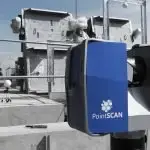
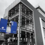
From concept to completion, PointSCAN’s 3D laser scanning applications provide measurable insights that enhance design accuracy, improve communication, and reduce costly rework. Our digital surveys deliver verified information you can trust — transforming how projects are planned, built, and maintained.
Innovative deliverables that enhance your workflow.
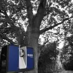
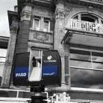
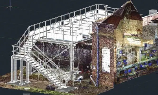
3D laser scanning captures millions of precise measurement points — but the real value lies in what happens next. PointSCAN transforms the raw scan data into a fully registered point cloud, providing an accurate 3D representation of the surveyed environment. This point cloud can be used directly for measurement and visualisation, or developed further into detailed 2D CAD drawings, 3D models, and BIM or virtual environments. Whatever the requirement, each output is tailored to deliver reliable, ready-to-use data that supports every stage of design, construction, and asset management.
PointSCAN's 3D laser survey applications benefit these sectors and more
Water & Wastewater
Engineering & Construction
Heritage & Restoration
Arboriculture
Buildings & Architecture
Film & Media
Utilising Point Clouds
3D point clouds are the first and most fundamental output from every laser scan. They capture millions of precise, geo-referenced measurements that create a true 3D representation of the surveyed environment. Point clouds can be used directly for measurement, visualisation, or design reference, or developed further into detailed 2D or 3D deliverables.
PointSCAN converts point cloud data into precise 2D CAD drawings, including plans, elevations, sections, and topographical surveys. These drawings are ideal for refurbishment, redevelopment, or record documentation and integrate seamlessly into AutoCAD or similar platforms.
Transform point cloud data into intelligent, 3D modelled geometry for visualisation, coordination, and construction. Models can be tailored to any Level of Detail (LOD) and exported in AutoCAD,Revit, IFC, SolidWorks and more, whichever formats to suit your workflow.
Bring your project to life with immersive, navigable 3D environments. PointSCAN creates VR-ready models and panoramic point clouds that allow clients and teams to explore spaces before construction begins — improving communication, stakeholder buy-in, and design confidence.
Accurate 3D data enables physical reproduction of scanned objects or environments at any scale. PointSCAN can supply watertight STL or OBJ models ready for additive manufacturing, allowing physical models to be produced directly from survey data.
Modern printing techniques enable fill size printing in all medials from polymers to metals, concrete stome and wood.
Common Uses:
Architectural and engineering prototypes
Heritage and museum replicas
Product or component design testing
Educational or exhibition models
Clients across the UK & Europe that have benefited from our 3D laser surveys.
Request a 3D Laser Survey Quotation
Receive a fast, accurate quotation for your next project — whether it’s industrial, commercial or residential. Provide a few project details below and one of our survey engineers will prepare a tailored proposal, including scope, deliverables and timescales
Alternatively give us a call on 01767 661400 and a member of our team will be happy to discus you project requirements
Are you waiting to see your measurement data?
PointSCAN’s expertise comes from capturing quality visual imagery and measurement data and presenting it in a digital format data that can be easily shared and utilised in multiple software formats.
Planning
Optimise 3D digital imagery to view your project, sharing and presenting site layouts for project meetings and presentations.
Engineering
Produce accurate CAD models and fabrication drawings directly from 3D scan data.
Capture retrospective building information to create verified interactive models.
Construction
3D laser scanning can be captured during construction without disruption to provide up-to-date progress reporting and as-built verification.
3D Topography
3D laser surveys acquire accurate measurements of natural and artificial site features which can be easily referenced to local or Global Positioning Systems (GPS) surveys.
Measured Building
Plans and elevations can easily be converted from 3D point cloud data.
Film & Media
Computer-generated imagery (CGI) in modern film and gaming production is replacing traditional special effects with digital visual effects. It allows for rooms, buildings, cities or entire planets to be created within the studio setting reducing production time and costs.
Heritage & Restoration
Accurate measurements of buildings and structures produce digital condition surveys and allow for re-constructive models to be produced.
As-Built
Identify differences between what has been designed and as-built, and verify with a point cloud overlay.
Quickly and accurately collect and record evidence from scenes following an incident, 3D laser scans minimise any disruption and return the area back to its original in a shorter period of time.
Whatever your requirement for on-site measurement data or 3D images let PointSCAN provide you with an innovative cost-effective solution.
Just some of the leading brands that have benefited from our 3D laser scanning services.
This website uses cookies to improve your experience. We'll assume you're ok with this, but you can opt-out if you wish.AcceptRead More
Privacy & Cookies Policy
Privacy Overview
This website uses cookies to improve your experience while you navigate through the website. Out of these, the cookies that are categorized as necessary are stored on your browser as they are essential for the working of basic functionalities of the website. We also use third-party cookies that help us analyze and understand how you use this website. These cookies will be stored in your browser only with your consent. You also have the option to opt-out of these cookies. But opting out of some of these cookies may affect your browsing experience.
Necessary cookies are absolutely essential for the website to function properly. This category only includes cookies that ensures basic functionalities and security features of the website. These cookies do not store any personal information.
Any cookies that may not be particularly necessary for the website to function and is used specifically to collect user personal data via analytics, ads, other embedded contents are termed as non-necessary cookies. It is mandatory to procure user consent prior to running these cookies on your website.