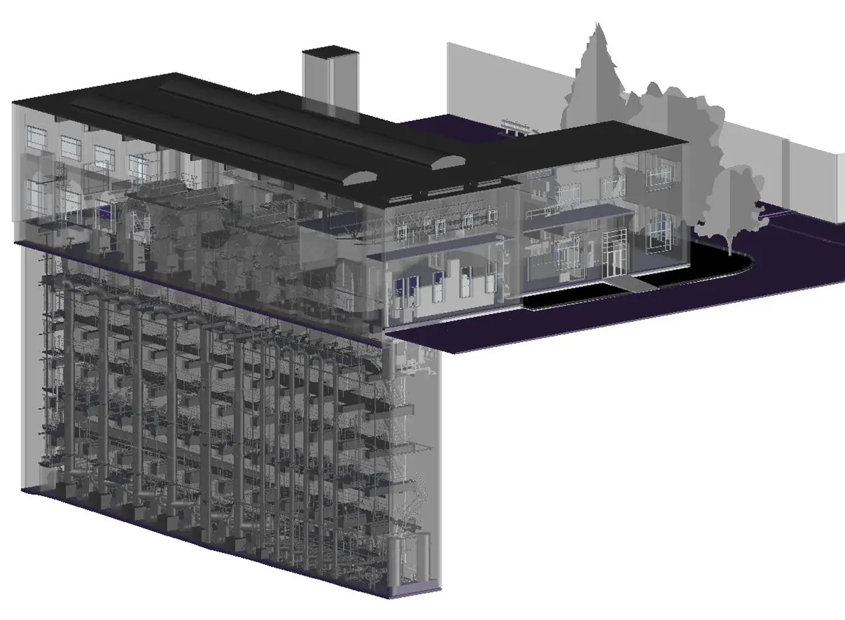
Delivering accurate measurement data for industrial, commercial, and residential projects — providing reliable 2D and 3D outputs for CAD and BIM applications.
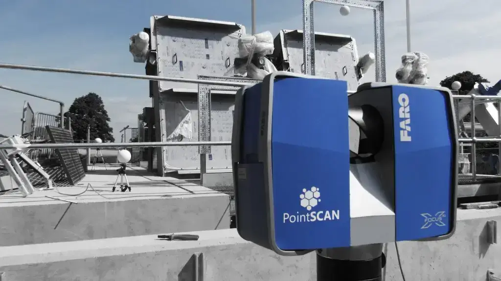
PointSCAN delivers measured building surveys using 3D laser scanning to provide accurate, consistent and reliable measurement data for industrial, commercial and residential projects. Our surveys are designed to support design, refurbishment, asset management and estate-wide programmes, with outputs structured to integrate seamlessly into CAD and BIM workflows.
By capturing high-density spatial data internally and externally, complex buildings can be recorded quickly and accurately, reducing the need for repeat site visits and minimising disruption to live or operational environments. This approach allows survey information to be reused across multiple disciplines and project stages, providing long-term value beyond a single set of drawings.
Each measured building survey is tailored to suit the required level of detail, ensuring that clients receive the right information for their project without unnecessary cost or over-modelling. Deliverables may include floor plans, elevations, sections, roof plans, 3D CAD models, BIM models or registered point clouds, depending on how the data will be used.
Our Surveys are Trusted by leading developers and design practices
Typical Measured Building Survey Deliverables
Depending on project requirements and the agreed level of detail, deliverables may include:
2D
Floor Plans Accurately measured layouts suitable for design development, space planning and statutory submissions.
Elevations External and internal elevations capturing façade geometry, openings and key features.
Sections Vertical and horizontal sections showing levels, structure and spatial relationships.
Roof Plans Measured roof geometry, plant locations and key features.
3D
CAD Models Modelled building geometry for coordination and design purposes.
BIM Models (Revit) Structured models suitable for refurbishment, asset management and information-led projects.
Registered Point Clouds Fully aligned and validated point cloud datasets, available for direct interrogation or downstream modelling.
Measured building surveys by PointSCAN are delivered as clear, usable digital outputs, structured to integrate directly into design, coordination and asset management workflows. All deliverables are produced from a registered, quality-assured survey dataset, ensuring consistency and accuracy across every output.
Typical outputs include:
Point cloud data (.E57, .RCP, .PTS, .LAS)
2D CAD drawings (plans, elevations, sections)
3D Revit / BIM models
TruView or JetStream online viewing portals
As simple as converting s point cloud to a 3D model
Survey data is produced with long-term usability in mind, allowing the same dataset to be reused for multiple outputs and future project stages. This reduces duplication, lowers overall project cost and provides a dependable digital record of the existing building.
By capturing a comprehensive and accurately registered survey dataset at the outset, information can be interrogated, modelled and repurposed as project requirements evolve. This enables additional drawings, models or analysis to be generated without returning to site, supporting design development, coordination and asset management over time.
Data is structured to integrate seamlessly into CAD and BIM workflows, ensuring consistency across deliverables and providing confidence that all outputs are derived from a single, verified source of truth.
Not every project requires the same level of detail. The effectiveness of a measured building survey depends on delivering the right information for the intended use, rather than capturing unnecessary detail that adds cost without value.
PointSCAN defines the level of detail at the outset of each project, ensuring survey outputs are aligned with how the data will be used — whether for planning, design development, coordination, refurbishment or asset management. This approach provides clarity for all stakeholders and ensures deliverables are both practical and proportionate.
Levels of detail may range from simplified geometric representations suitable for early-stage design, through to highly detailed models capturing architectural, structural and building features where required. By agreeing the level of detail in advance, survey data can be modelled efficiently while maintaining accuracy and consistency across all outputs.
This structured approach allows projects to scale logically, with additional detail introduced only when needed. As a result, clients receive survey information that is fit for purpose, cost-effective and capable of supporting future project stages.
The cost of a measured building survey depends on factors such as building size, complexity, access, occupancy and the level of detail required. Each survey is scoped to ensure costs are proportionate to how the data will be used, rather than applying a generic approach.
Using 3D laser scanning allows accurate measurement data to be captured efficiently, reducing time on site and minimising disruption. This is particularly beneficial for complex or occupied buildings and can help control overall project costs.
Value is delivered through the accuracy, reusability and longevity of the survey data. A single, well-structured dataset can support multiple outputs, reduce the need for repeat surveys and provide a dependable digital record for future project stages. Survey scope and deliverables are agreed in advance to ensure outputs are fit for purpose, cost-effective and aligned with programme requirements.
Measured building surveys are delivered using a structured, repeatable process designed to ensure accuracy, consistency and reliability across every project. From initial scoping through to final deliverables, each stage is carefully managed to provide confidence in the data produced.
Survey requirements are defined at the outset, including scope, access considerations, deliverables and levels of detail. This ensures all stakeholders have a clear understanding of the survey objectives before work begins.
3D laser scanning is used to capture high-density spatial data internally and externally, with surveys planned to minimise disruption to occupied or operational environments. Data is registered, validated and checked to confirm accuracy before any drawings or models are produced.
All outputs are generated from a single, verified survey dataset, ensuring consistency across drawings, models and point cloud deliverables. Quality checks are applied throughout the process, with final outputs reviewed to confirm they meet agreed project requirements.
This approach allows surveys to be delivered efficiently, scaled across multiple buildings where required, and reused for future project stages with confidence.
Request a Measured Building Survey Quotation
Receive a fast, accurate quotation for your next project — whether it’s industrial, commercial or residential. Provide a few project details below and one of our survey engineers will prepare a tailored proposal, including scope, deliverables and timescales
Alternatively give us a call on 01767 661400 and a member of our team will be happy to discus you project requirements
This website uses cookies to improve your experience. We'll assume you're ok with this, but you can opt-out if you wish.AcceptRead More
Privacy & Cookies Policy
Privacy Overview
This website uses cookies to improve your experience while you navigate through the website. Out of these, the cookies that are categorized as necessary are stored on your browser as they are essential for the working of basic functionalities of the website. We also use third-party cookies that help us analyze and understand how you use this website. These cookies will be stored in your browser only with your consent. You also have the option to opt-out of these cookies. But opting out of some of these cookies may affect your browsing experience.
Necessary cookies are absolutely essential for the website to function properly. This category only includes cookies that ensures basic functionalities and security features of the website. These cookies do not store any personal information.
Any cookies that may not be particularly necessary for the website to function and is used specifically to collect user personal data via analytics, ads, other embedded contents are termed as non-necessary cookies. It is mandatory to procure user consent prior to running these cookies on your website.