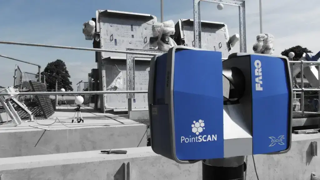
Survey Documentation is the process of transforming high-accuracy 3D laser scan data into clear, usable information that supports every stage of your project. It provides the drawings, models and digital outputs that designers, engineers and project teams rely on for confident planning and decision-making.
Unlike traditional documentation based on manual measurements or outdated records, survey-derived documentation reflects the real-world conditions of your site with precision. Whether you need detailed 2D drawings, intelligent 3D models, BIM-ready information or immersive digital environments, accurate documentation ensures that everyone is working from the same reliable source.
By converting complex scan data into structured, easy-to-use deliverables, survey documentation becomes the foundation of informed design, coordinated construction and effective asset management.
2D Documentation – Accurate Drawings from Verified Scan Data
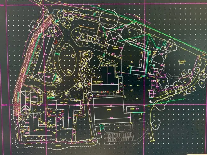
2D documentation remains one of the most important deliverables in design, planning and construction. Using precise point clouds captured during the survey, we produce reliable plans, elevations, sections, topographic drawings and services layouts that accurately reflect the real conditions on site. Because every drawing is created directly from verified scan data, you benefit from a level of accuracy that traditional measurement methods cannot achieve.
Our 2D documentation supports early feasibility studies, planning submissions, heritage work, technical design and full construction issue packages. By working from a true as-built record, project teams can reduce assumptions, avoid clashes and coordinate designs with far greater confidence. All drawings are produced to your required level of detail, formatted to your standards and delivered ready for integration into any CAD workflow.
High-quality 2D documentation forms the foundation of a successful project and provides a dependable reference throughout the entire lifecycle of the asset.
Trusted by leading developers, engineers and design practices
3D Documentation – Reliable Digital Models
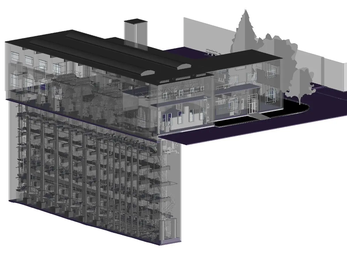
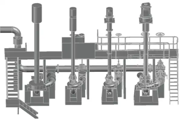
3D documentation provides an accurate digital representation of your site, created directly from the verified point cloud. Models can range from simple massing to detailed architectural, structural and MEP elements, depending on your required level of detail. Because every component is modelled from real measurements, the final output reflects true site conditions with high precision.
These models support design development, coordination, visualisation, clash detection and prefabrication. Using the point cloud as the reference geometry allows designers and engineers to make confident decisions without relying on outdated drawings or assumptions. Proposed elements can also be tested within the existing environment to check fit and improve installation accuracy.
All models are delivered in Revit, AutoCAD, IFC or other standard formats, ensuring seamless integration with your workflow.
BIM – Coordinated, Data-Rich Models for Smarter Delivery
BIM documentation provides an intelligent model of your site, created directly from verified point cloud data. Each model is built to your required Level of Detail (LOD) and Level of Information (LOI), ensuring it contains the geometric accuracy and structured metadata needed for design, coordination and long-term asset management.
These BIM-ready models support clash detection, spatial planning, digital rehearsals and multidisciplinary coordination, allowing teams to identify issues early and reduce rework. Because the model is based on true site conditions, it becomes a reliable single source of truth throughout the project.
All BIM documentation can be delivered in Revit, IFC or other industry-standard formats, integrating seamlessly into your project workflow and supporting more efficient, informed decision-making.
Different projects require different levels of information, and not every situation needs a fully detailed model. While 3D laser scanners capture large amounts of highly accurate data, the Level of Detail (LOD) defines how much of that information is represented in your drawings or models. Higher LODs include more geometry, complexity and modelling time, which naturally increases file size and cost. Choosing the right LOD ensures you receive documentation that is both accurate and appropriate for your project needs.
Our LOD options range from simple 2D linework to fully detailed 3D models. For example, you may require the external building envelope at LOD1, while the internal plant or equipment is modelled at LOD4. By applying the correct LOD in the right areas, we create clear, efficient and cost-effective documentation tailored to your project.
Receive a fast, accurate quotation for your next project — whether it’s industrial, commercial or residential. Provide a few project details below and one of our survey engineers will prepare a tailored proposal, including scope, deliverables and timescales
Alternatively give us a call on 01767 661400 and a member of our team will be happy to discus you project requirements
This website uses cookies to improve your experience. We'll assume you're ok with this, but you can opt-out if you wish.AcceptRead More
Privacy & Cookies Policy
Privacy Overview
This website uses cookies to improve your experience while you navigate through the website. Out of these, the cookies that are categorized as necessary are stored on your browser as they are essential for the working of basic functionalities of the website. We also use third-party cookies that help us analyze and understand how you use this website. These cookies will be stored in your browser only with your consent. You also have the option to opt-out of these cookies. But opting out of some of these cookies may affect your browsing experience.
Necessary cookies are absolutely essential for the website to function properly. This category only includes cookies that ensures basic functionalities and security features of the website. These cookies do not store any personal information.
Any cookies that may not be particularly necessary for the website to function and is used specifically to collect user personal data via analytics, ads, other embedded contents are termed as non-necessary cookies. It is mandatory to procure user consent prior to running these cookies on your website.