Topographical surveys or land surveys capture accurate site elevations and measurement data from natural and artificial topographic features along with specified boundary information. These form an essential part of any project planning when looking to make changes to a site’s existing use.
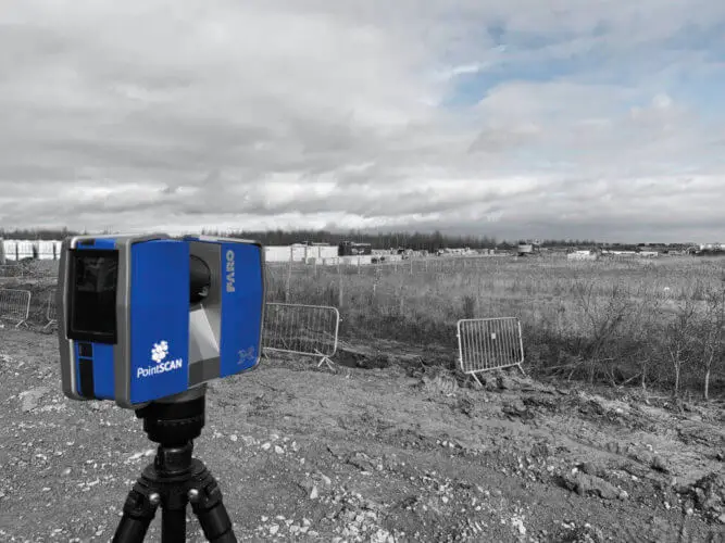
By utilising 3D laser technology, we can acquire point data which provides additional benefits by creating visual representations of the site in the form of high-definition panoramic imagery and 3D point clouds. PointSCAN provide topographic surveys throughout the UK and unlike traditional survey techniques where measurement data is taken from spot height, 3D topographical surveys record points as detailed as 1mm apart.
Furthermore, by combining high-resolution imagery, a topographical survey can be viewed, interrogated and shared quickly and easily. Therefore enabling project teams, contractors and supply chains access to the same high-quality information.
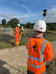
SETTING OUT
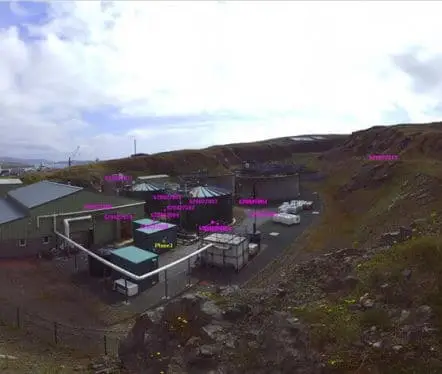
HD IMAGERY
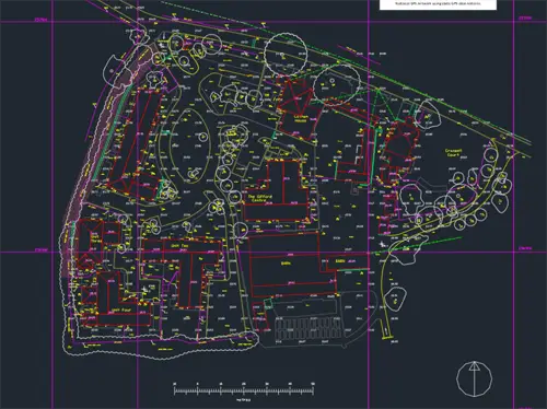
TOPOGRAPHICAL PLANS
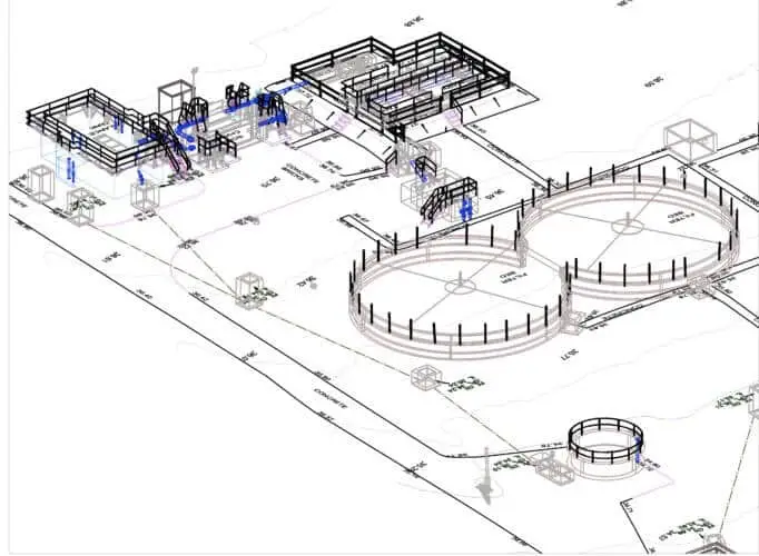
3D LASER SURVEY
Virtual Reality
Topographic Point Clouds
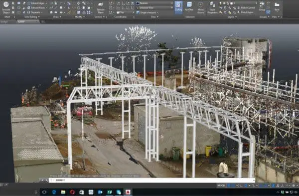
Created directly from 3D laser scan data, a topographic point cloud provides a quick and accurate representation of a site’s environment without the need for additional CAD modelling. With location data available from every point, overlay simulations, as shown in the image, offer an excellent opportunity to visually analyse how a completed project will look. Furthermore, immersive virtual reality gives you the ability to stand within your model and review your topographical survey design.
Created directly from 3D laser scan data, a topographic point cloud provides a quick and accurate representation of a site’s environment without the need for additional CAD modelling. With location data available from every point overlay simulations, as shown, offer an excellent opportunity to visually analyse how a completed project will look. Furthermore, immersive virtual reality gives you the ability to stand within your model and review your topographical survey design.
As the name would suggest, a ‘Digital Twin‘ provides an exact representation of the environment captured in the 3D topographical survey. As a result, a site can be revisited safely and cost-effectively as many times as you wish.
Accessing your topographical survey data couldn’t be easier with 3D modelling and 2D plans available in multi-format outputs such as .DWG, DXF. Hard copies also present sitemaps at 1:50. 1:100, 1:200, 1:500, 1:1000, 1:1250 scale factors.
How to create a Digital Twin
As the name would suggest, a ‘Digital Twin‘ provides an exact representation of the environment captured in the 3D topographical survey. As a result, a site can be revisited safely and cost-effectively as many times as you wish.
Accessing your topographical survey data couldn’t be easier with 3D modelling and 2D plans available in multi-format outputs such as .DWG, DXF. Hard copies also present sitemaps at 1:50. 1:100, 1:200, 1:500, 1:1000, 1:1250 scale factors.
3D Topographic Land Survey
Land surveys can be completed safely and quickly by our experienced land surveyors, obtaining accurate site data with little or no disruption to existing site activities.
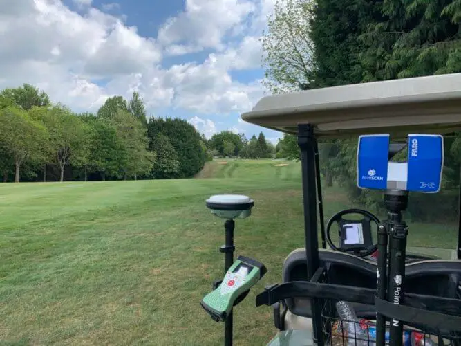
GNSS / GPS navigation systems provide precise location positioning anywhere in the UK. As a result, registered point clouds can be geo-referenced against local or national OS coordinate systems.
Topographic Land Survey
Land surveys can be completed safely and quickly by our experienced land surveyors, obtaining accurate site data with little or no disruption to existing site activities.
GNSS / GPS navigation systems provide precise location positioning anywhere in the UK. As a result, registered point clouds can be geo-referenced against local or national O.S. coordinate systems.
"Create savings you didn't know you were going to spend."
Making our surveys work for you.
3D topographical surveys acquire significantly more data than traditional land surveys and can save up to 80% of time spent on site. Therefore offering a cost-effective solution for your on-site measurement needs, especially when factoring in the added benefits and savings against cost and time.
Even the simplest errors in design can prove costly. Minimising these and saving unplanned costs using accurate, easily recognisable site data and reducing delays, avoid second, third and even fourth visits to site to sort out changes in design by using a single topographical survey to provide verified measurement data for all your different trades to work from.
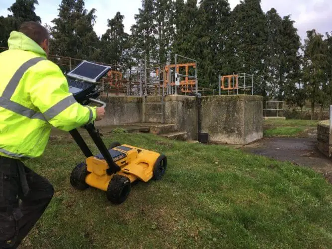
Ground penetrating radar (GPR) surveys completed alongside 3D topographic data collection provide the location of underground structures and existing services.
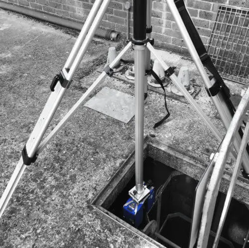
Inverted laser scanning allows for accurate measurement data to be collected safely from tanks, chambers and confined spaces.
This website uses cookies to improve your experience. We'll assume you're ok with this, but you can opt-out if you wish.AcceptRead More
Privacy & Cookies Policy
Privacy Overview
This website uses cookies to improve your experience while you navigate through the website. Out of these, the cookies that are categorized as necessary are stored on your browser as they are essential for the working of basic functionalities of the website. We also use third-party cookies that help us analyze and understand how you use this website. These cookies will be stored in your browser only with your consent. You also have the option to opt-out of these cookies. But opting out of some of these cookies may affect your browsing experience.
Necessary cookies are absolutely essential for the website to function properly. This category only includes cookies that ensures basic functionalities and security features of the website. These cookies do not store any personal information.
Any cookies that may not be particularly necessary for the website to function and is used specifically to collect user personal data via analytics, ads, other embedded contents are termed as non-necessary cookies. It is mandatory to procure user consent prior to running these cookies on your website.