How to seek it's full potential beyond CAD conversion.
A point cloud is a highly accurate digital dataset made up of millions of measured points captured during a 3D laser survey. Each point contains real-world spatial information — X, Y and Z coordinates — which combine to form a complete 3D representation of buildings, structures, equipment, land or confined spaces. Because every point is a direct measurement, the point cloud reflects the true conditions on site with exceptional precision.
A point cloud is the first deliverable produced from a 3D laser survey and is far more powerful than many people realise. It provides a detailed, navigable visualisation of the scanned environment, allowing teams to inspect, measure, and understand the site long before any CAD or BIM modelling begins. Designers, engineers and clients can rotate, section, annotate and explore the dataset, making it an invaluable tool for presenting existing conditions, reviewing constraints and communicating design intent.
Beyond its visual benefits, the point cloud forms the foundation for creating as-built drawings, 3D models, BIM deliverables, clash detection, measurement extraction and digital analysis. When used to its full potential, it becomes a complete digital reference of the site — not just a transition between scanning and CAD, but a robust dataset that supports confident, informed decision-making throughout the entire project lifecycle.
How Point Clouds Are Created.
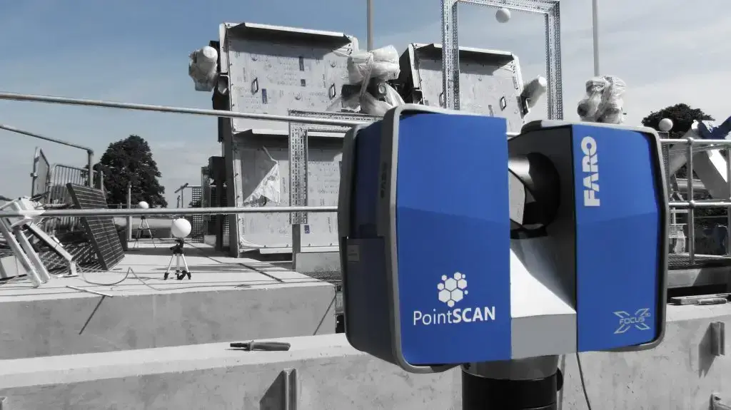
A point cloud is produced using survey-grade LiDAR during a 3D laser survey. The scanner emits rapid pulses of laser light, measuring how long each pulse takes to return. This return time is converted into an exact position, capturing hundreds of thousands of measurements every second.
Multiple scan positions are taken around the site to achieve full line-of-sight coverage. These scans are then aligned using advanced software to create one unified dataset containing millions of precisely coordinated points.
Because the process is entirely non-contact, point clouds can be captured safely in operational buildings, industrial plants and confined spaces. The result is an accurate 3D dataset that reflects real site conditions and forms the foundation for all further modelling and analysis.
Both formats deliver the same measurement accuracy — the choice simply depends on whether speed or visual clarity is more important for your project.
Grey Scale
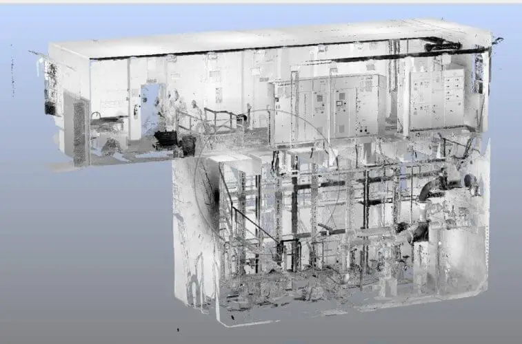
Most point clouds are captured in grey scale, as it is the most efficient and reliable method for recording 3D data. Grey scale scanning allows more scan positions to be completed per visit and performs consistently in all lighting conditions, since the laser is unaffected by shadows, darkness, or glare. This makes it ideal for industrial, water, wastewater and low-light environments.
Colourised Point Clouds
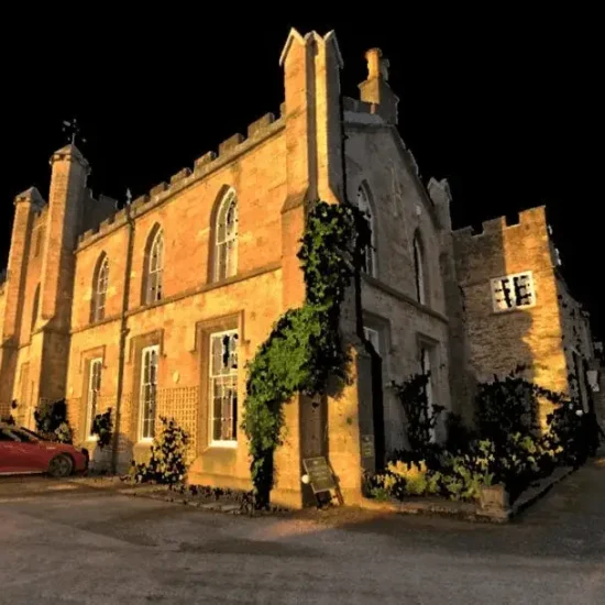
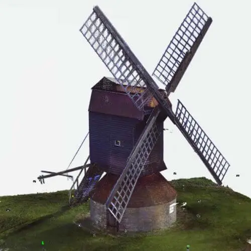
Combining the scan data with photographs taken by the scanner. These images are mapped onto the 3D points to produce a visually recognisable digital replica of the site. Colour makes it easier to identify materials, finishes, services, hazards and access points at a glance. It is especially useful for presentations, client communication, heritage documentation, and projects where visual context improves understanding.
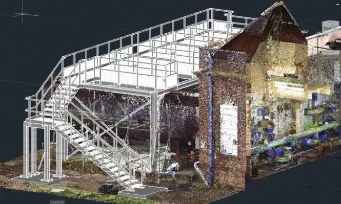
Instead of modelling the entire local environment, a point cloud can be used as the primary reference dataset, with new CAD or BIM elements placed directly into the 3D scan. This approach avoids unnecessary modelling, reduces cost, and significantly speeds up the design process.
Why this approach is effective:
Integrate CAD models directly into point clouds – Insert proposed equipment, structures or fabrication models into the scanned environment to check fit, alignment and clashes.
Avoid modelling everything – Only the new or altered components need to be created in CAD; the point cloud provides the surrounding context.
Faster decision-making – Designers can instantly see how new elements interact with real-world conditions.
Reduced rework – Clashes and access issues are identified early, improving accuracy before fabrication or installation.
Point clouds offer a powerful, efficient alternative to full-model workflows — delivering clarity without the extra modelling effort.
Registered point clouds can be transformed into smooth, high-quality 3D fly-throughs that provide a clear and immersive view of your site. These guided animations help teams and stakeholders understand complex environments, visualise constraints, and communicate design intentions without needing specialist software. Whether showcasing hazardous areas, documenting existing conditions, or presenting proposals, fly-throughs turn raw scan data into an accessible and compelling visual tool.
Unlock the Full Value of Your Point Cloud Data
A well-captured point cloud is far more than a collection of measurements — it becomes a long-term digital asset that supports every stage of a project. From initial feasibility checks to detailed design, coordination, clash detection, fabrication and future maintenance, point clouds provide a reliable reference that teams can return to again and again. When utilised correctly, they reduce site visits, minimise risk, and improve the speed and accuracy of decision-making.
Whether you need a simple visual record, CAD-ready datasets, highly detailed BIM models or immersive fly-throughs, PointSCAN ensures your point cloud is registered, processed and delivered to the standard your project demands. Our survey specialists help you get the most from your data, enabling clearer communication, confident planning and a more efficient project workflow.
Accurate. Accessible. Future-proof. Your project starts with better information.
Receive a fast, accurate quotation for your next project — whether it’s industrial, commercial or residential. Provide a few project details below and one of our survey engineers will prepare a tailored proposal, including scope, deliverables and timescales
Alternatively give us a call on 01767 661400 and a member of our team will be happy to discus you project requirements
This website uses cookies to improve your experience. We'll assume you're ok with this, but you can opt-out if you wish.AcceptRead More
Privacy & Cookies Policy
Privacy Overview
This website uses cookies to improve your experience while you navigate through the website. Out of these, the cookies that are categorized as necessary are stored on your browser as they are essential for the working of basic functionalities of the website. We also use third-party cookies that help us analyze and understand how you use this website. These cookies will be stored in your browser only with your consent. You also have the option to opt-out of these cookies. But opting out of some of these cookies may affect your browsing experience.
Necessary cookies are absolutely essential for the website to function properly. This category only includes cookies that ensures basic functionalities and security features of the website. These cookies do not store any personal information.
Any cookies that may not be particularly necessary for the website to function and is used specifically to collect user personal data via analytics, ads, other embedded contents are termed as non-necessary cookies. It is mandatory to procure user consent prior to running these cookies on your website.