
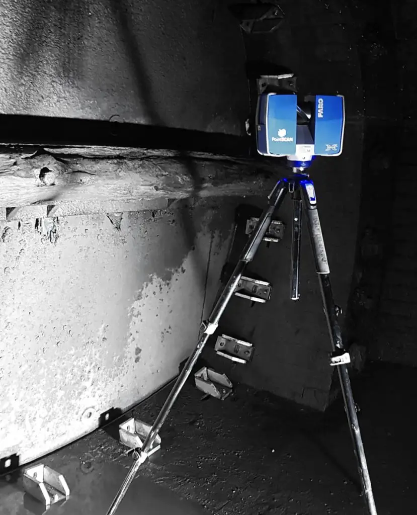
3D laser scanning, also known as LiDAR (Light Detection and Ranging), has emerged as a revolutionary technology in various industries, including the management and mapping of underground utilities. Underground utilities, such as water pipes, sewer systems, gas lines, and electrical conduits, are critical infrastructures that require precise documentation, regular maintenance, and careful planning for any construction activities. Traditional methods of mapping these utilities are often time-consuming, expensive, and prone to inaccuracies. 3D laser scanning offers a highly accurate, efficient, and non-invasive solution to these challenges.
The Technology Behind 3D Laser Scanning
3D laser scanning involves emitting laser beams to capture precise details of the environment. The scanner sends out millions of laser pulses per second, which bounce back after hitting an object. The time it takes for each pulse to return to the scanner is used to calculate the distance between the scanner and the object, creating a detailed three-dimensional map of the area. When used for underground utilities, this technology can either directly scan accessible utilities or be combined with other methods like Ground Penetrating Radar (GPR) to locate and map utilities buried beneath the surface.
Benefits of 3D Laser Scanning for Underground Utilities
1. Accuracy and Precision
One of the primary advantages of 3D laser scanning is its high level of accuracy and precision. Traditional surveying methods can have significant margins of error, leading to potential conflicts and damages during excavation or construction. In contrast, 3D laser scanning provides detailed and accurate data, reducing the risk of errors and ensuring that the exact location and dimensions of underground utilities are known.
2. Speed and Efficiency
3D laser scanning is significantly faster than conventional methods. Traditional utility mapping can take days or even weeks, depending on the complexity of the infrastructure. A 3D laser scanner can collect comprehensive data in a fraction of the time, often within hours. This speed not only saves time but also reduces the costs associated with prolonged surveying activities.
3. Non-Invasive
Conventional methods of locating underground utilities often involve invasive procedures, such as digging trial holes, which can be disruptive and costly. 3D laser scanning is a non-invasive technique that minimises disruption to the surface and surrounding environment. This is particularly beneficial in urban areas where digging can cause significant inconvenience and hazards.
4. Comprehensive Data Collection
3D laser scanning captures a wealth of data that can be used for multiple purposes. It provides a detailed 3D model of the underground utilities, which can be integrated with Geographic Information Systems (GIS) for better planning and management. This comprehensive data collection allows for more informed decision-making and effective maintenance strategies.

Applications of 3D Laser Scanning in Underground Utilities
1. Utility Mapping and Documentation
Accurate mapping and documentation are essential for the maintenance and expansion of underground utilities. 3D laser scanning can create precise maps that detail the location, size, and condition of pipes, cables, and other utilities. These maps are invaluable for urban planners, engineers, and maintenance crews, ensuring that they have up-to-date and accurate information at their fingertips.
2. Condition Assessment
Underground utilities are subject to wear and tear, corrosion, and other forms of degradation over time. Regular condition assessments are necessary to ensure the integrity and functionality of these systems. 3D laser scanning can detect and document the condition of underground utilities, identifying issues such as leaks, cracks, or blockages. This proactive approach allows for timely maintenance and repairs, preventing costly failures and service disruptions.
3. Construction Planning and Risk Management
Construction activities often pose a risk to existing underground utilities. Accidental damage to these utilities can result in costly repairs, project delays, and safety hazards. 3D laser scanning provides accurate data that helps in the planning and execution of construction projects, minimising the risk of damaging underground utilities. By knowing the exact location and depth of these utilities, construction teams can avoid potential conflicts and ensure the safety and success of their projects.
4. Asset Management
Effective asset management is crucial for utility companies and municipalities. 3D laser scanning provides detailed and up-to-date records of underground utilities, which are essential for managing assets throughout their lifecycle. This includes planning for upgrades, extensions, and replacements, as well as responding to emergencies and maintaining regulatory compliance.
5. Integration with BIM and GIS
Building Information Modelling (BIM) and Geographic Information Systems (GIS) are powerful tools for managing infrastructure projects. 3D laser scanning data can be seamlessly integrated into BIM and GIS platforms, providing a comprehensive view of both above-ground and underground utilities. This integration enhances collaboration between different stakeholders, improves project planning and execution, and facilitates more efficient and effective management of utility networks.

Challenges and Considerations
While 3D laser scanning offers numerous benefits for underground utilities, there are also challenges and considerations to keep in mind.
1. Initial Costs
The initial investment in 3D laser scanning technology can be significant. This includes the cost of the equipment, software, and training for personnel. However, the long-term savings in time, accuracy, and reduced risks often outweigh these initial costs.
2. Data Management
The vast amount of data generated by 3D laser scanning requires effective management and storage solutions. Organisations need to invest in robust data management systems to handle, process, and store the data, ensuring it is accessible and useful for various applications.
3. Integration with Existing Systems
Integrating 3D laser scanning data with existing GIS, BIM, and asset management systems can be complex. It requires careful planning and collaboration between different departments and stakeholders to ensure seamless integration and maximise the benefits of the technology.
4. Expertise and Training
Effective use of 3D laser scanning technology requires specialised knowledge and skills. Organizations need to invest in training their personnel or hiring experts to operate the equipment, process the data, and interpret the results accurately.
3D laser scanning is transforming the way underground utilities are mapped, documented, and managed. Its high accuracy, efficiency, and non-invasive nature make it an invaluable tool for utility companies, municipalities, and construction professionals. By providing detailed and precise data, 3D laser scanning helps to ensure the integrity and functionality of underground utilities, reduce risks during construction, and improve overall asset management. As the technology continues to advance, it is likely to become an even more integral part of managing underground infrastructure, contributing to safer, more efficient, and more sustainable utility networks.
Interested in using 3D laser scanning for your project? Contact PointSCAN by clicking the button below.