
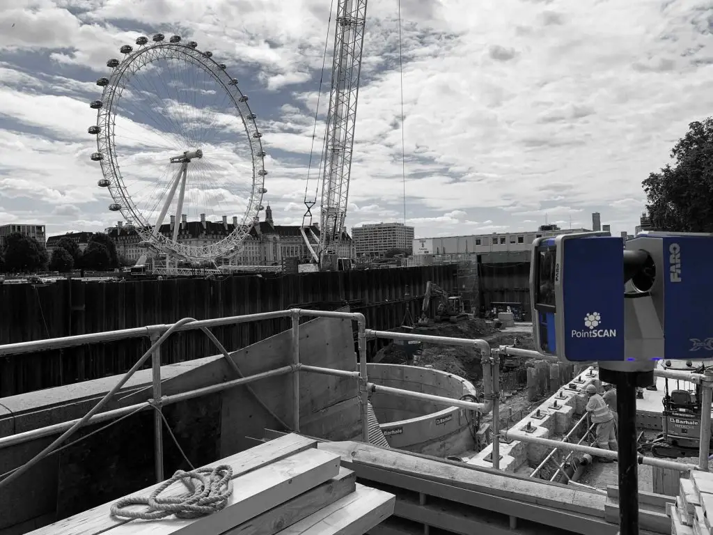
3D laser scanning technology, also known as LiDAR (Light Detection and Ranging), has revolutionised project planning across various industries, including construction, architecture, engineering, and manufacturing. By providing accurate, high-resolution, three-dimensional representations of existing conditions, this technology enhances the planning process in multiple ways, improving efficiency, accuracy, and collaboration. This article explores the various benefits and applications of 3D laser scanning in project planning.
Accurate Data Collection
One of the primary advantages of 3D laser scanning is its ability to collect precise data. Traditional surveying methods often involve manual measurements, which can be time-consuming and prone to human error. In contrast, 3D laser scanners can capture millions of data points per second, creating a detailed point cloud that accurately represents the scanned environment. This high level of accuracy is crucial for project planning, as it ensures that all dimensions and spatial relationships are captured correctly, reducing the risk of errors and rework later in the project.
Enhanced Visualisation
The point clouds generated by 3D laser scanning can be converted into detailed 3D models, providing a clear and comprehensive visualisation of the project site. These models allow stakeholders to see a virtual representation of the site, which can be particularly useful for identifying potential issues and making informed decisions. For example, architects can use the models to better understand the spatial relationships between different elements of a building, while engineers can analyse structural components more effectively. Enhanced visualisation helps in identifying clashes, interferences, and spatial constraints early in the planning process, leading to better-designed projects.
Improved Collaboration and Communication
3D laser scanning facilitates improved collaboration and communication among project stakeholders. The detailed 3D models can be shared with team members, clients, and other stakeholders, providing a common visual reference that everyone can understand. This shared understanding helps to align expectations, reduce misunderstandings, and foster better collaboration. Additionally, the models can be integrated into Building Information Modeling (BIM) systems, further enhancing collaboration by allowing different disciplines to work together in a coordinated manner.
Efficient Site Analysis
Conducting a thorough site analysis is a critical step in project planning. 3D laser scanning enables efficient and comprehensive site analysis by quickly capturing detailed information about the existing conditions. This data can be used to create accurate topographical maps, identify potential hazards, and assess the suitability of the site for the proposed project. For example, in construction, laser scanning can help identify uneven terrain, underground utilities, and other site-specific challenges that need to be addressed before construction begins. By providing a clear understanding of the site conditions, 3D laser scanning helps project planners develop more effective and realistic plans.

Cost and Time Savings
3D laser scanning can lead to significant cost and time savings throughout the project lifecycle. The accuracy and detail provided by laser scanning reduce the likelihood of errors and rework, which can be costly and time-consuming. Additionally, the speed at which data can be collected and processed means that project planners can obtain the information they need more quickly, allowing for faster decision-making and project progression. In the long term, these efficiencies can lead to shorter project timelines and lower overall costs, providing a competitive advantage for companies that adopt this technology.
Historic Preservation and Restoration
For projects involving historic preservation and restoration, 3D laser scanning is an invaluable tool. Historic structures often have intricate details and unique architectural features that need to be preserved. Traditional measurement methods may not capture these details accurately, but 3D laser scanning can create a precise digital record of the structure. This record can be used to guide restoration efforts, ensuring that the original features are preserved. Additionally, the digital models can be archived for future reference, providing a valuable resource for ongoing preservation efforts.
Integration with Modern Technologies
3D laser scanning technology integrates seamlessly with other modern technologies used in project planning, such as BIM, Geographic Information Systems (GIS), and virtual reality (VR). BIM integration allows for the creation of intelligent models that include not only geometric information but also data about materials, costs, and schedules. GIS integration enables the incorporation of spatial data, such as land use, zoning, and environmental information, into the planning process. VR integration provides immersive experiences that allow stakeholders to explore and interact with the project site in a virtual environment. These integrations enhance the overall planning process by providing a more comprehensive and interactive approach to project development.
Quality Control and Assurance
During the construction phase, 3D laser scanning can be used for quality control and assurance. By comparing the as-built conditions to the as-designed models, project managers can identify deviations and ensure that construction is proceeding according to plan. This process helps to catch and correct errors early, reducing the risk of costly rework and ensuring that the final product meets the project specifications. Regular scanning throughout the construction phase also provides a detailed record of progress, which can be valuable for documentation and future reference.
Not only does 3D laser scanning save costs, but also ensures safety for the construction process and the final project. PointSCAN’s laser scanning was used for Jaguar’s World Record for the iconic James Bond barrel roll stunt from “The Man with the Golden Gun.” The scans ensured the minute measurements were correct which was critical for the safely of the stunt driver. Find out more about this project here.
Sustainability and Environmental Impact
3D laser scanning contributes to more sustainable project planning by enabling better analysis of environmental impacts. Accurate data on the existing site conditions allows planners to assess the potential effects of the project on the environment and develop strategies to mitigate negative impacts. For example, planners can use the data to design projects that minimise land disturbance, reduce waste, and optimise resource use. Additionally, the ability to create precise models and plans reduces the likelihood of errors and rework, which can generate additional waste and environmental impact.
Future Developments and Innovations
As technology continues to advance, the capabilities of 3D laser scanning are likely to expand, leading to even greater benefits for project planning. Innovations such as mobile laser scanning, drone-mounted scanners, and real-time data processing are already emerging, offering new possibilities for data collection and analysis. These advancements will further enhance the accuracy, efficiency, and versatility of 3D laser scanning, making it an increasingly indispensable tool for project planners.
3D laser scanning is a powerful tool that significantly enhances project planning across various industries. By providing accurate data collection, enhanced visualisation, improved collaboration, efficient site analysis, and cost and time savings, it addresses many of the challenges associated with traditional planning methods. Its integration with modern technologies and its applications in historic preservation, quality control, sustainability, and future innovations further demonstrate its value. As the technology continues to evolve, its impact on project planning is likely to grow, leading to even more efficient, accurate, and successful projects.
Ensure your project plans are clear and accurate: contact PointSCAN below.